© OpenStreetMap contributors · OpenMapTiles · OpenFreeMap · Mapterhorn
Meet the AI Assistant in Studio
Describe an animation in your own words, review the proposed edits and apply them to a map you can keep editing. You can also paint territories directly on the canvas.
In MapsAnimation, one instruction can turn into a camera shot, an on-screen title, an animated route and an audio track in the same project. This walkthrough uses a demo composition and a schematic crossing of the Alps to show how those pieces fit together.
Where to find it
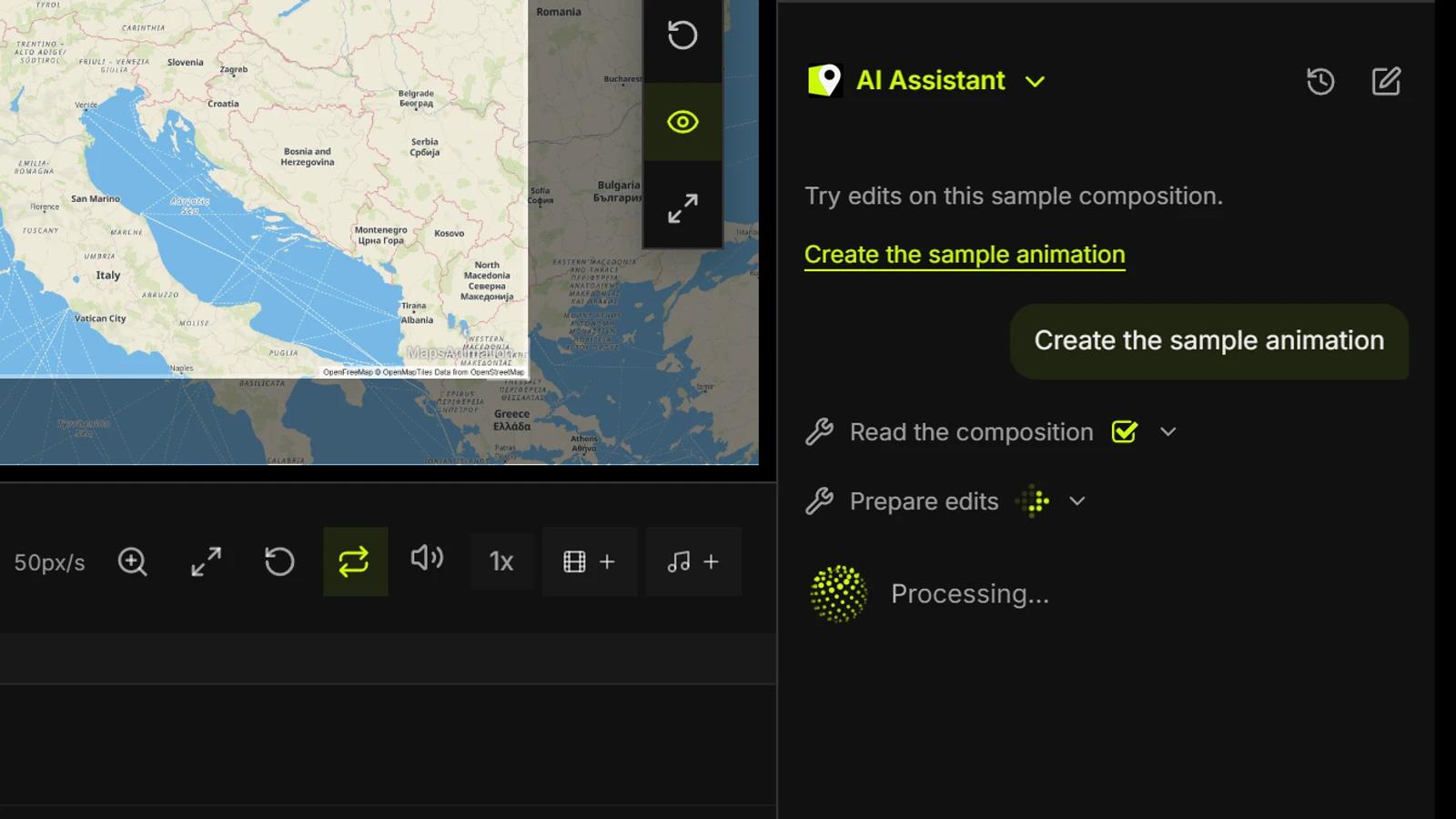
Open a saved project in Studio and expand AI Assistant in the lower-right corner of the desktop editor, next to the timeline. Type what you want to achieve and send the instruction. The assistant starts from the open composition, including unsaved edits in that tab. You can start a new chat or reopen the project's chat history. Chats expire 14 days after creation.
From an instruction to a proposal
Try something specific: “Create an eight-second shot from Lyon to Turin. Push the camera in, reveal the route progressively and put the title in the lower corner.” The assistant can find places and assets, inspect the composition and combine multiple edits in one proposal. Expand the list to review the operations, then choose Apply in Studio. If you edited the project in the meantime, resend the instruction so the assistant can use the latest state.
What it can edit and how to keep working
Ask for changes to projection, style, labels, weather or filters; a new framing, camera move or preset; text, shapes, icons, routes and measurements; or adjustments to duration, clip ranges, audio and keyframes. It can also search Studio's catalogs and prepare export settings such as format, size and time range within your plan limits. After applying, play the shot, adjust its layers and tracks, or use Undo. Start the export from Studio when you're ready.
Once the first shot is in place, refine it with a follow-up. Try “Make the route wider and finish drawing it at five seconds” or “Move the title to the top and add a sound effect at four seconds.” Naming the layer and the exact time helps the assistant identify the intended edit.
Paint territories on the map
Choose Fill territory in the map toolbar or press B. Let zoom pick the level, or select continent, country, state or province, municipality or district, or neighborhood where boundaries are available. Hover to preview the boundary and click to paint. On a touchscreen, tap once to preview and again to confirm. You can adjust the layer's color, opacity, outline and time range. The assistant can also propose a fill when it finds a boundary for the requested area.