© OpenStreetMap contributors · OpenMapTiles · OpenFreeMap · Mapterhorn
21 new map styles to tell your world's stories
Pixel World, watercolor, paper cut, atlases and city lights: explore the new MapsAnimation styles and choose a look for your next journey.
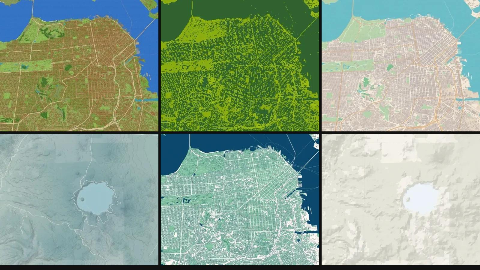
Studio gains 21 styles that change how a place looks, from block cities and retro screens to ink, fabric and nighttime lights. They join the previous 16 styles, bringing the catalog to 37. Change your map's visual language while continuing to work with the camera, routes and annotations in your composition.
Pixel World: geography with a block character
Pixel World turns land surfaces, water and buildings into block cartography with original materials. Forests, beaches, snow and crops have distinct textures; trees and decorative details appear as you zoom in. Buildings keep their locations and roads follow their geographic paths.
Try an angled camera to see the volumes, or enable terrain to explore its plateaus. Vegetation is an artistic interpretation of available land cover, and relief depends on elevation data: this is not a tree inventory or an editable block world.
Four more ways to explore pixels
Pixel Quest brings stepped coastlines and an adventure look. Pocket LCD reduces the background to four green shades with retro dithering. Pixel Diorama combines façades, windows and roofs with a camera you can still move freely. Terminal Atlas interprets map shapes as a grid of dots with a monospace character.
The routes and text you add retain their colors and independent controls. Choose a retro background while keeping annotations readable; in Diorama, tilt the camera to appreciate buildings wherever data is available.
Nine finishes in paper, ink and fabric
Watercolor combines pigment washes and soft edges; Toner uses black and white masses; Pencil sketch adds graphite and hatching; Woodcut works with incisions and warm paper. Paper cut and Felt atlas build elevation bands from terrain, adding shadows and, in felt, fibers and stitching.
Newspaper offers halftones and editorial lettering; Treasure chart, sepia paper and echoed coastlines; Pop Comic, strong outlines and dot patterns. Try them for travel journals, visual stories and explanatory maps. Compare a city view with a mountain scene: materials and elevation bands read differently depending on the framing.
Six atlases for journeys, landscapes and cities
Nautical chart brings pale coastlines, a graticule and faceted relief. Mineral combines dark masses, turquoise and ochre label plates. Prairie offers warm city colors and quiet lines. Neon Grid brings a glowing graticule and color accents to a dark map.
Road Atlas emphasizes red roads and condensed labels; Nordic Topo combines cyan water, pink roads and elevation contours. Choose a style to suit your story and check your route's contrast. Nautical chart is a visual style without bathymetry or navigation certification; Mineral's colors represent map surfaces, not geological formations.
Earth at night: the world after dark
Earth at night displays NASA's 2012 Suomi NPP VIIRS nighttime mosaic at a source resolution of 500 meters. Explore urban networks, long journeys and globe views against a dark background. It does not show live lighting or photographic detail of individual buildings.
Find it in the satellite maps category. It requires satellite access through Pro or Enterprise. Read about the observations in NASA's Earth at Night.
Try them in your next composition
Open Studio, select Base Map and browse Pixel & digital, Illustrated, Atlas or Satellite maps. Artistic styles require Pro or Enterprise; if your plan does not include a category, the selector offers an upgrade. See the available plans.
Changing styles preserves your composition. Adjust labels, points of interest, buildings and camera with the usual controls, then check framing and the contrast of routes and text. These styles share Studio's eight projections and its image and video composition system. Export formats and limits depend on your plan.
The interface and selector names are available in all 16 site languages. This article's screenshots come from a real demonstration composition. The map engine uses MapLibre GL JS; data credits accompany the images.